Vredehoek CID Area and Map
Boundary expanded
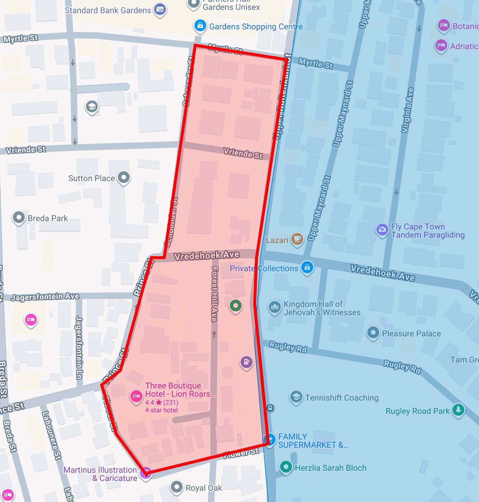
(13 March 2026) The boundary has been expanded to include properties between Upper Buitenkant St and Schoonder, Prince and Flower Streets. This expansion was by request of ratepayers in this area.
(16 October 2025) The boundary has been expanded to cover more of Vredehoek, based on feedback from residents. The expanded map is below.
The Vredehoek CID covers the Vredehoek & Devil’s Peak neighbourhoods, and is bounded by:
- Jutland Avenue/Philip Kgosana Drive to the north;
- Upper Buitenkant Street, Schoonder St, Flower St, and Upper Buitenkant Street (becoming Gorge Street) to the west;
- Table Mountain National Park to the south and east — excluding High Cape and Disa Park.

Why are Disa Park and High Cape excluded?
Disa Park has private security and parking facilities which owners already pay for. Similarly, High Cape owners already contribute towards homeowners associations that provide additional services in those areas.
Can the excluded areas join the CID later?
Yes, if the CID is approved, then the boundary can be expanded if the impacted ratepayers vote for it. A new voting process would need to take place. The benefit would be that the CID will then have the funds and staff to help expand the boundary and include these areas.
Will excluded areas benefit from the CID's services?
The CID is not allowed to provide services outside of its boundaries.
Why was the map boundary changed?
The map boundary was changed twice.
- 13 March 2026: The boundary has been expanded to include properties between Upper Buitenkant St and Schoonder, Prince and Flower Streets. This expansion was by request of ratepayers in this area.
-
16 October 2025: Initially, the map excluded some areas that were predominantly sectional title properties (flats). This was based on discussions with other CIDs that indicated that it’s significantly more difficult to contact sectional title owners and get them to cast their votes (either for or against the CID). Based on feedback from residents and with the approval of the City, the map boundary was expanded to include these areas.